- Printed on Polypropylene (plastic)
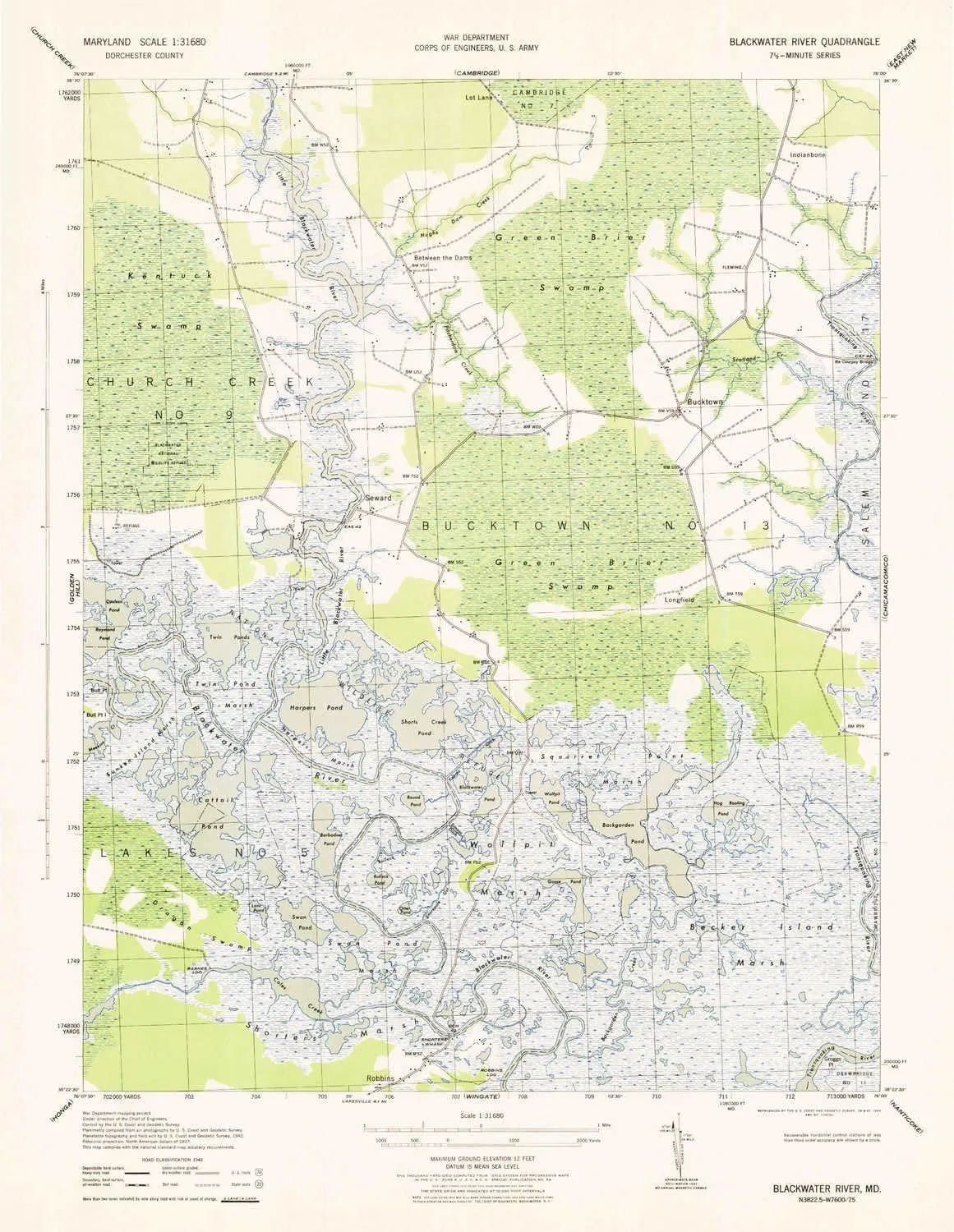
- USGS topographic map of Blackwater River, MD, at 1:31680 scale. Heavier material. Waterproof. Tear-resistant. Foldable. Perfect for the outdoors.
- Cities, towns, villages: Barnes Landing,Indianbone,Bucktown,Robbins Landing,Longfield,Robbins,Seward
- Islands: Bull Point Island
- Parks and forests: Blackwater National Wildlife Refuge
USGS topographic map of Blackwater River, Maryland, dated 1943.
Includes geographic coordinates (latitude and longitude), lines of elevation, bodies of water, roads, and more. This topo quad is suitable for recreational, outdoor uses, office applications, or wall map framing.
Printed on-demand by YellowMaps on the print material of your choice.
Shipping rolled from Minneapolis, MN, United States.
Product Number: USGS-5930267
Map Size: 21 inches high x 16.2 inches wide
Map Scale: 1:31680
Map Type: POD USGS Topographic Map
Map Series: HTMC
Map Version: Historical
Cell ID: 4274
Scan ID: 461374
Woodland Tint: Yes
Survey Year: 1942
Datum: NAD27
Map Projection: Polyconic
Map published by United States Army Corps of Engineers
Map published by United States Department of War
Map Language: English
Scanner Resolution: 600 dpi
Map Cell Name: Blackwater River
Grid size: 7.5 X 7.5 Minute
Date on map: 1943
Geographical region: Maryland, United States
Northern map edge Latitude: 38.5°
Southern map edge Latitude: 38.375°
Western map edge Longitude: -76.125°
Eastern map edge Longitude: -76°
Surrounding map sheets (copy & paste the Product No. in the search bar):
North: USGS-5365882,USGS-5365884,USGS-5365886,USGS-5367630,USGS-5365888
East: USGS-5365948,USGS-5365944,USGS-5367640,USGS-5365950,USGS-5365946
South: USGS-5367888,USGS-5367554,USGS-5367558,USGS-5367552,USGS-5367556
West: USGS-5367696,USGS-5366354,USGS-5366348,USGS-5366352,USGS-5366350


