- FOR THE EXPLORER: Plan your trip to the Yosemite Valley, the Coastal Redwoods, or find the spot of your favorite recreation areas nearby
- ACCURATE DATA: Road conditions and recreation potential are verified by field-checkers exploring the American West and beyond
- TRUSTED PUBLISHER: Our award-winning team of cartographers and editors work tirelessly to present the landscapes and data that travelers must have in order to maximize their experience
- HIGH QUALITY PRINT: Printed on polypropylene. The material is stronger than most papers and unlikely to crease or rip. The matte finish eliminates glare, and adds texture to the map. Ideal for display. Please note this map is NOT laminated - the page is not appropriate for dry-erase markers.
- ROLLED IN A STURDY TUBE: Your map is rolled and packaged in a sturdy tube to protect it during shipment
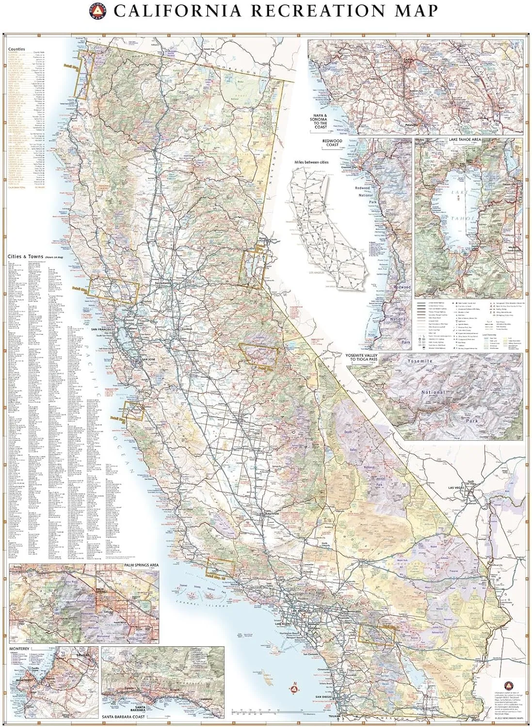
Few places in the world can claim such diverse landscapes and seascapes as California. This map illustrates The Golden State’s network of highways that grant road travelers access to iconic natural features like Death Valley, Lake Tahoe, Yosemite Valley, and the Coastal Redwoods to name a few.
Printed on polypropylene. The material is stronger than most papers and unlikely to crease or rip. The matte finish eliminates glare, and adds texture to the map. Ideal for display. Please note this map is NOT laminated - the page is not appropriate for dry-erase markers. Your map is rolled and packaged in a sturdy tube to protect it during shipment.


 - 3 Day/72 Hour Ready to Eat Supply for Camping, Hiking, Disaster Preparedness - 5 Year Shelf Life Energy Survival Food")


