- Printed on Tyvek® (synthetic)
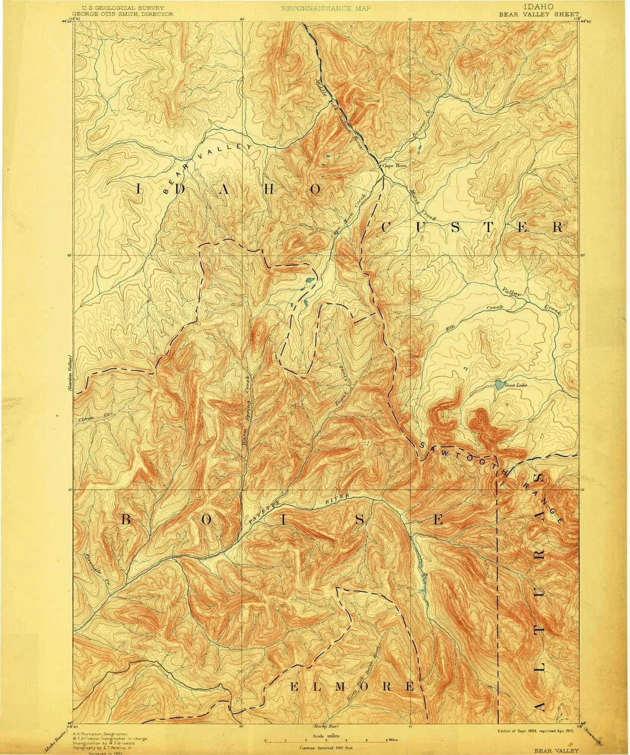
- USGS topographic map of Bear Valley, ID, at 1:125000 scale. Lighter material. Waterproof. Tear-resistant. Foldable. Very durable. Perfect for backpacking and the outdoors.
- Cities, towns, villages: Cape Horn (historical),Camp Creek Summer Home Area,Bear Creek Summer Home Area,Grandjean
- Mountains: Eightmile Mountain,Williams Peak,Monte Verita,Edaho Mountain,Miller Mountain,Cape Horn Mountain,Reward Peak,Mount Regan,Tohobit Peak,Cape Horn Summit,Observation Peak,Vanity Summit,Picket Mountain
- Valleys: Willis Gulch,Bear Valley
USGS topographic map of Bear Valley, Idaho, dated 1893, updated 1910.
Includes geographic coordinates (latitude and longitude), lines of elevation, bodies of water, roads, and more. This topo quad is suitable for recreational, outdoor uses, office applications, or wall map framing.
Printed on-demand by YellowMaps on the print material of your choice.
Shipping rolled from Minneapolis, MN, United States.
Product Number: USGS-5437196
Map Size: 18.8 inches high x 15.7 inches wide
Map Scale: 1:125000
Map Type: POD USGS Topographic Map
Map Series: HTMC
Map Version: Historical
Cell ID: 64964
Scan ID: 239452
Imprint Year: 1910
Survey Year: 1891
Datum: Unstated
Map Projection: Unstated
Map published by United States Geological Survey
Map Language: English
Scanner Resolution: 600 dpi
Map Cell Name: Bear Valley
Grid size: 30 X 30 Minute
Date on map: 1893
Geographical region: Idaho, United States
Northern map edge Latitude: 44.5°
Southern map edge Latitude: 44°
Western map edge Longitude: -115.5°
Eastern map edge Longitude: -115°
Surrounding map sheets (copy & paste the Product No. in the search bar):
North: USGS-5436692,USGS-5436690,USGS-5432610
East: USGS-5437176,USGS-5433956,USGS-5437256,USGS-5433952,USGS-5433954
South: USGS-5437346,USGS-5430470,USGS-5437348,USGS-5437352,USGS-5437344
West: USGS-5433406,USGS-5437258,USGS-5437260

 by Samuel Augustus Mitchell")


")

