- Printed on Polypropylene (plastic)
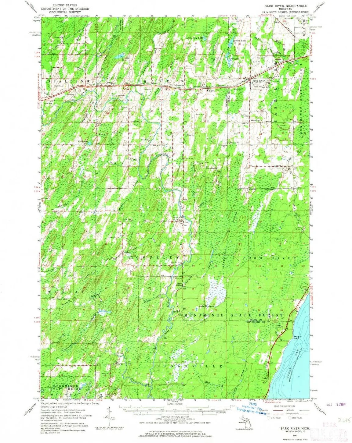
- USGS topographic map of Bark River, MI, at 1:62500 scale. Heavier material. Waterproof. Tear-resistant. Foldable. Perfect for the outdoors.
- Cities, towns, villages: Wilson,Indiantown,Harris,Gourley,Hannahville,Bark River,Houle
- Islands: Consult topo map preview for visible islands.
- Parks and forests: Escanaba River State Forest,Pulaski Park
USGS topographic map of Bark River, Michigan, dated 1963, updated 1964.
Includes geographic coordinates (latitude and longitude), lines of elevation, bodies of water, roads, and more. This topo quad is suitable for recreational, outdoor uses, office applications, or wall map framing.
Printed on-demand by YellowMaps on the print material of your choice.
Shipping rolled from Minneapolis, MN, United States.
Product Number: USGS-5442372
Map Size: 21 inches high x 17 inches wide
Map Scale: 1:62500
Map Type: POD USGS Topographic Map
Map Series: HTMC
Map Version: Historical
Cell ID: 50948
Scan ID: 277982
Imprint Year: 1964
Woodland Tint: Yes
Aerial Photo Year: 1954
Field Check Year: 1963
Datum: NAD27
Map Projection: Polyconic
Map published by United States Geological Survey
Map Language: English
Scanner Resolution: 600 dpi
Map Cell Name: Bark River
Grid size: 15 X 15 Minute
Date on map: 1963
Geographical region: Michigan, United States
Northern map edge Latitude: 45.75°
Southern map edge Latitude: 45.5°
Western map edge Longitude: -87.5°
Eastern map edge Longitude: -87.25°
Surrounding map sheets (copy & paste the Product No. in the search bar):
North: USGS-5443272,USGS-5443274,USGS-5441654
East: USGS-5442584,USGS-5439352,USGS-5442586
South: USGS-5442464,USGS-5442462,USGS-5440294,USGS-5442460
West: USGS-5440192,USGS-5443174


, Portable Dish Tub with Drain Plug, Space-Saving Drying Rack for Kitchen, Camping, Laundry use")


