- Printed on Polypropylene (plastic)
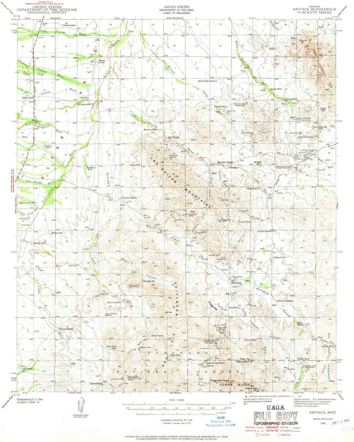
- USGS topographic map of Arivaca, AZ, at 1:62500 scale. Heavier material. Waterproof. Tear-resistant. Foldable. Perfect for the outdoors.
- Cities, towns, villages: Arivaca,Secundino,Puertocito,Las Guijas
- Islands: Consult topo map preview for visible islands.
- Parks and forests: Buenos Aires National Wildlife Refuge
USGS topographic map of Arivaca, Arizona, dated 1941, updated 1969.
Includes geographic coordinates (latitude and longitude), lines of elevation, bodies of water, roads, and more. This topo quad is suitable for recreational, outdoor uses, office applications, or wall map framing.
Printed on-demand by YellowMaps on the print material of your choice.
Shipping rolled from Minneapolis, MN, United States.
Product Number: USGS-5547430
Map Size: 20.8 inches high x 17 inches wide
Map Scale: 1:62500
Map Type: POD USGS Topographic Map
Map Series: HTMC
Map Version: Historical
Cell ID: 50672
Scan ID: 314328
Imprint Year: 1969
Woodland Tint: Yes
Survey Year: 1941
Datum: NAD27
Map Projection: Polyconic
Map published by United States Geological Survey
Map published by United States Army Corps of Engineers
Map Language: English
Scanner Resolution: 600 dpi
Map Cell Name: Arivaca
Grid size: 15 X 15 Minute
Date on map: 1941
Geographical region: Arizona, United States
Northern map edge Latitude: 31.75°
Southern map edge Latitude: 31.5°
Western map edge Longitude: -111.5°
Eastern map edge Longitude: -111.25°
Surrounding map sheets (copy & paste the Product No. in the search bar):
North: USGS-5552066,USGS-5552064,USGS-5548400,USGS-5548402,USGS-5548398
East: USGS-5548874,USGS-5548876,USGS-5548880,USGS-5548872,USGS-5554300
South: USGS-5551332,USGS-5551330,USGS-5548392,USGS-5548396,USGS-5548394
West: USGS-5682729,USGS-5555160,USGS-5682727,USGS-5555158,USGS-5682725


")


 for Boys")


