- Printed on Polypropylene (plastic)
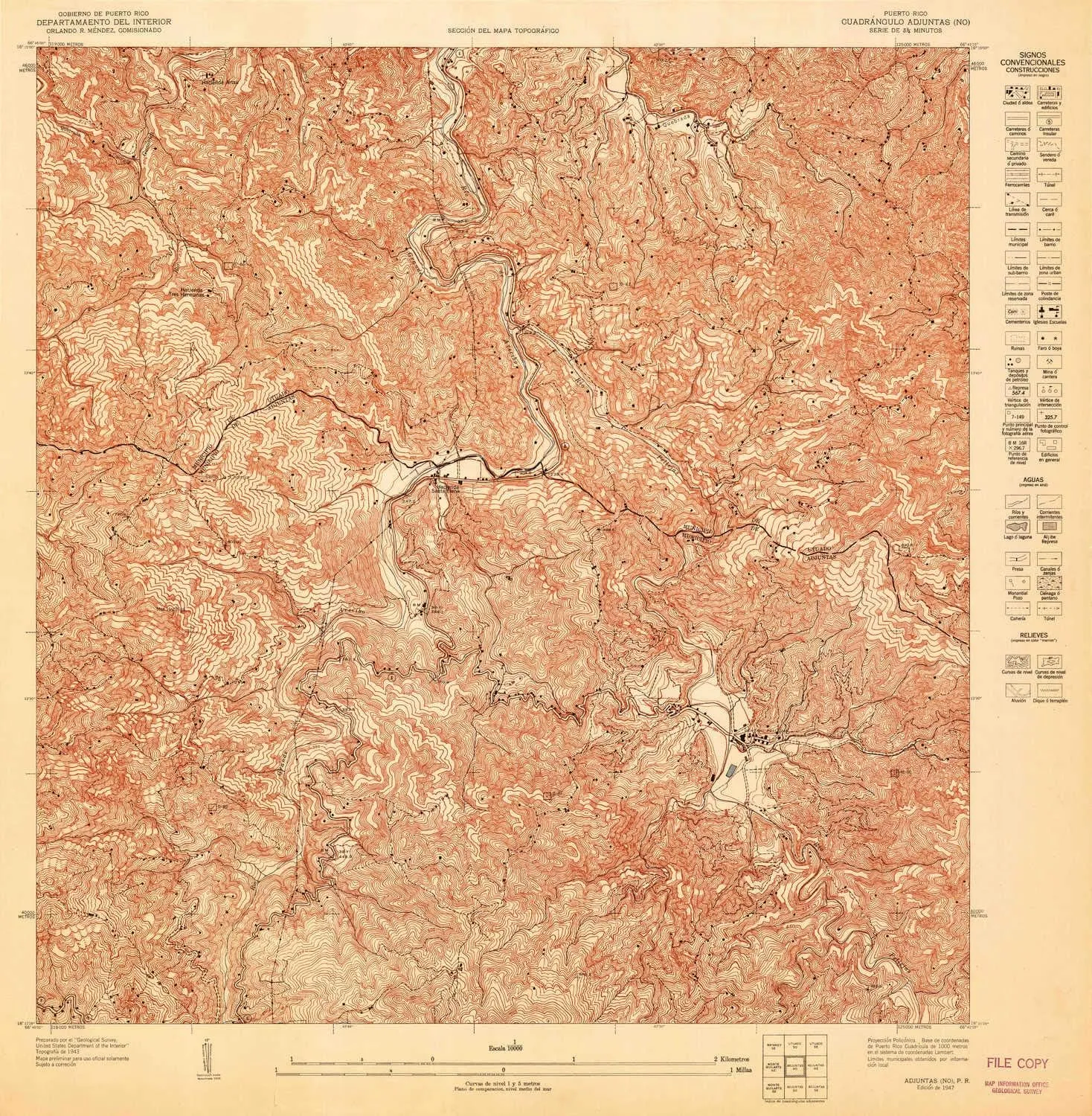
- USGS topographic map of Adjuntas NO, PR, at 1:10000 scale. Heavier material. Waterproof. Tear-resistant. Foldable. Perfect for the outdoors.
- Cities, towns, villages: Hacienda Santa Elena,Hacienda Artau,Hacienda Tres Hermanas,Pellejas
- Islands: Consult topo map preview for visible islands.
- Parks and forests: National Parks, National Forests, etc. Please preview map image for specifics.
USGS topographic map of Adjuntas NO, Puerto Rico, dated 1947.
Includes geographic coordinates (latitude and longitude), lines of elevation, bodies of water, roads, and more. This topo quad is suitable for recreational, outdoor uses, office applications, or wall map framing.
Printed on-demand by YellowMaps on the print material of your choice.
Shipping rolled from Minneapolis, MN, United States.
Product Number: USGS-5654000
Map Size: 31.1 inches high x 30.5 inches wide
Map Scale: 1:10000
Map Type: POD USGS Topographic Map
Map Series: HTMC
Map Version: Historical
Cell ID: 285961
Scan ID: 361917
Survey Year: 1943
Datum: Unstated
Map Projection: Polyconic
Map published by United States Geological Survey
Map Language: Spanish
Scanner Resolution: 600 dpi
Map Cell Name: Adjuntas NW
Grid size: 3.75 X 3.75 Minute
Date on map: 1947
Geographical region: Puerto Rico, United States
Northern map edge Latitude: 18.25°
Southern map edge Latitude: 18.1875°
Western map edge Longitude: -66.75°
Eastern map edge Longitude: -66.6875°
Surrounding map sheets (copy & paste the Product No. in the search bar):
North: USGS-5655048,USGS-5655054,USGS-5655050,USGS-5655064,USGS-5655062
East: USGS-5653998
South: USGS-5654004
West:


 for Emergency Survival Kits, Camping, Hiking, All-Weather Magnesium Ferro Rod")


