Cooking Essentials&Outdoor Tools|Foldable Shovels,Windproof Stoves&Headlamps
Cooking Essentials&Outdoor Tools|Foldable Shovels,Windproof Stoves&Headlamps Cooking Essentials&Outdoor Tools|Foldable Shovels,Windproof Stoves&Headlamps
Home Navigation Gear Laminated Hiking Map
ACT & Environs Wall Map 1952

ACT & Environs Wall Map 1952

$ 59.95

$ 0.00

Save: $

Finish:
  • Paper
  • Laminated
  • Laminated with Hang Rails
  • Canvas
  • Canvas with Hang Rails
Unavailable
Please select combo product attributes
The combo subtotal is $,SAVE$

Product Details

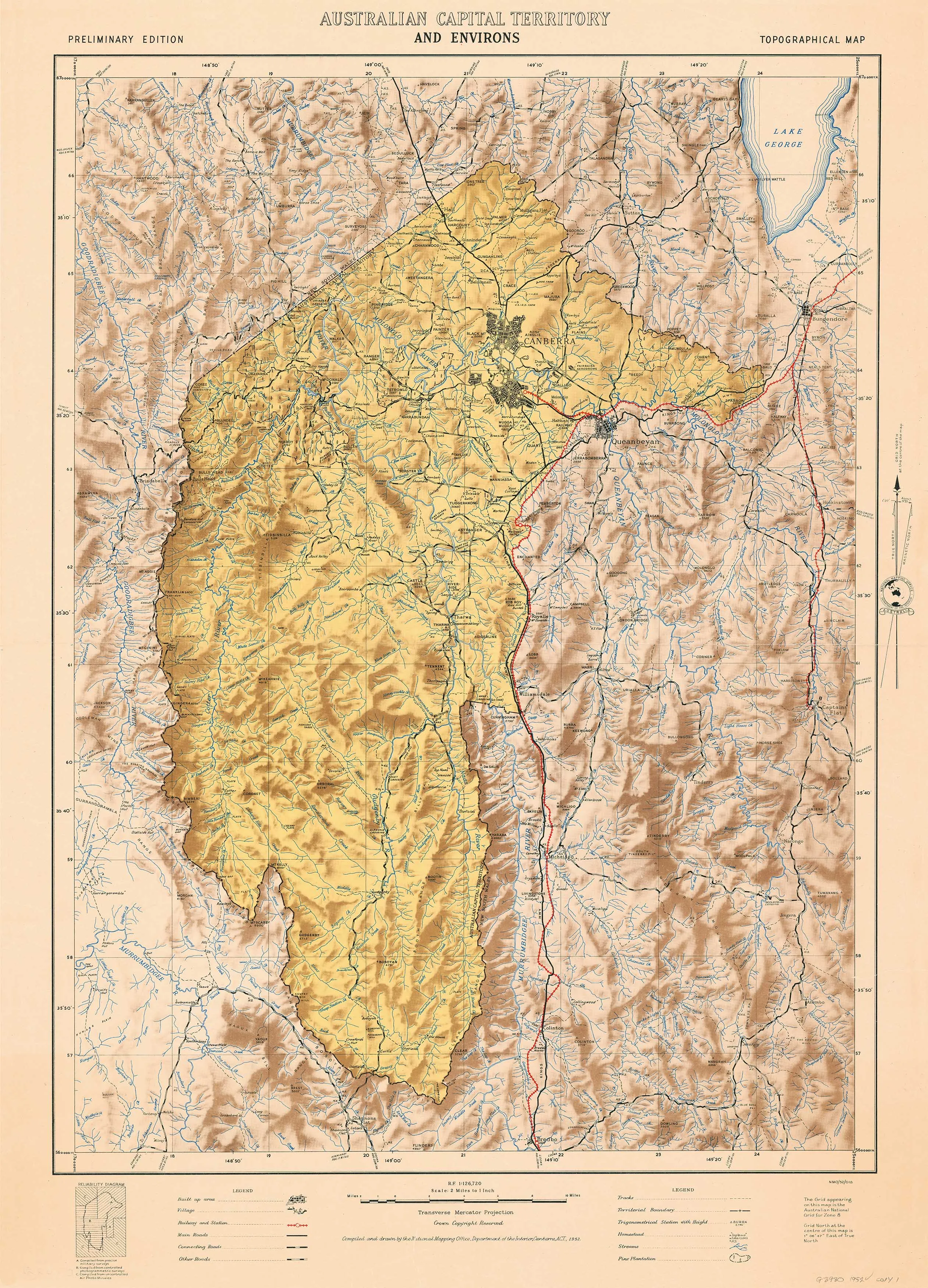
Australian Capital Territory and environs topographical map from 1952 with hill shading. This striking map was compiled and drawn by the National Mapping Office, Department of the Interior, Canberra.

The map can come either printed on heavyweight 160 gsm paper or laminated. The paper version is perfect for framing under glass, and the laminated version is exceptionally hard-wearing as we use a true encapsulation of two pieces of 80-micron gloss laminate.

Alternatively, we can supply this map on 395 gsm HP Professional Matte Canvas using pigment-based inks - making the map highly durable and fade resistant. The exceptional clarity of printing makes this map a stunning addition to any room, and its high quality means that it will provide years of enjoyment.

The easiest way to hang your canvas map is by having wooden hang rollers attached top and bottom with a hanging cord on the top roller, so all you have to do is put a hook on the wall. The hang rails come lacquered in a natural timber colour.

Note: Please allow ten working days for delivery of hang-railed maps as they need to be attached by our framer. 

Published: 1952

Size: 680 xmm x 950 mm

You May Also Like

Dyas AL topo map, 1:50000 Scale, 15 X 15 Minute, Historical, 2003, 29.1 x 22.1 in

$ 52.00

$ 74.00

Save: $

Hazlehurst MS topo map, 1:24000 Scale, 7.5 X 7.5 Minute, Historical, 1963, Updated 1964, 27 x 22 in

$ 45.00

$ 64.00

Save: $

Tents for Camping Beach Tents Waterproof Foldable Camping Tent Double Layer Tent Fishing Mountaineering 3-4 Person Family Tent Outdoor Tent Family Tents for Camping Hiking Traveling

$ 100.00

$ 250.00

Save: $

WOWULOVELY Girls Boy's Winter Ski Jackets Waterproof Kids Snowboarding Jacket Snow Coat Thicken Warm Hooded Ski Jacket

$ 42.00

$ 60.00

Save: $

Compact Tactical Folding Shovel

$ 18.00

Save: $

Frontenac Provincial Park Map - Waterproof - 6th Edition

$ 22.95

Save: $

MAGNESIUM FIRE STARTER

$ 7.99

Save: $

Men's Lightweight Softshell Vest Outerwear Windproof Puffer Sleeveless Jacket for Golf Running

$ 18.00

$ 23.00

Save: $

Little Donkey Andy Women's Lightweight Softshell Vest, Windproof Sleeveless Jacket for Running Hiking Travel

$ 33.00

$ 47.00

Save: $

Appalachian Trail Map, Swatara Gap to Delaware Water Gap [PA]

$ 14.95

Save: $

Cart
Cooking Essentials&Outdoor Tools|Foldable Shovels,Windproof Stoves&Headlamps
Your cart is currently empty.