- Printed on Tyvek® (synthetic)
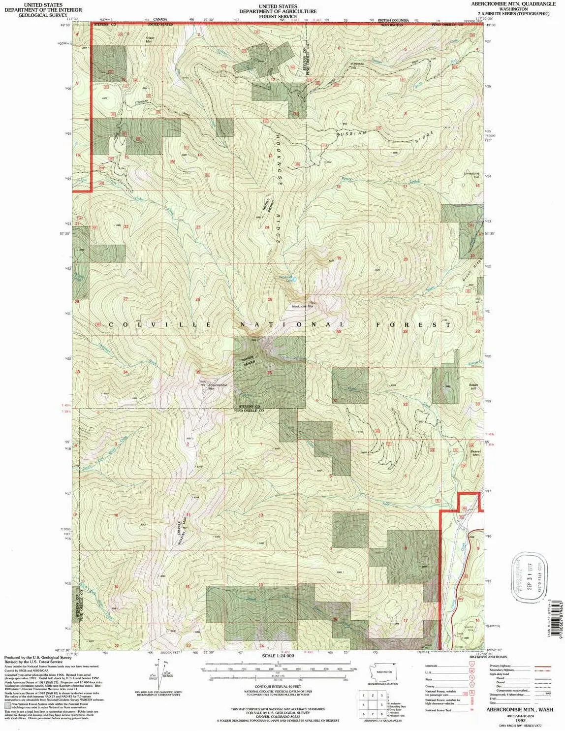
- USGS topographic map of Abercrombie Mtn, WA, at 1:24000 scale. Lighter material. Waterproof. Tear-resistant. Foldable. Very durable. Perfect for backpacking and the outdoors.
- Cities, towns, villages: Please see map preview to find populated places, townships, as well as roads and street names if available.
- Mountains: Hooknose Mountain,Beaver Mountain,Basalt Hill,Frisco Mountain,Limestone Hill,Abercrombie Mountain
- Valleys: Low elevation topographic features such as flatlands, river valleys, and canyons.
USGS topographic map of Abercrombie Mtn, Washington, dated 1992, updated 1997.
Includes geographic coordinates (latitude and longitude), lines of elevation, bodies of water, roads, and more. This topo quad is suitable for recreational, outdoor uses, office applications, or wall map framing.
Printed on-demand by YellowMaps on the print material of your choice.
Shipping rolled from Minneapolis, MN, United States.
Product Number: USGS-5958123
Map Size: 26.94 inches high x 21.57 inches wide
Map Scale: 1:24000
Map Type: POD USGS Topographic Map
Map Series: HTMC
Map Version: Historical
Cell ID: 46
Scan ID: 239721
Imprint Year: 1997
Woodland Tint: Yes
Aerial Photo Year: 1991
Field Check Year: 1992
Datum: NAD27
Map Projection: Lambert Conformal Conic
Map published by United States Geological Survey
Map published by United States Forest Service
Keywords: Overedge with No Adjacent Map
Map Language: English
Scanner Resolution: 600 dpi
Map Cell Name: Abercrombie Mountain
Grid size: 7.5 X 7.5 Minute
Date on map: 1992
Geographical region: Washington, United States
Northern map edge Latitude: 49°
Southern map edge Latitude: 48.875°
Western map edge Longitude: -117.5°
Eastern map edge Longitude: -117.375°
Surrounding map sheets (copy & paste the Product No. in the search bar):
North:
East: USGS-5402900,USGS-5402898,USGS-5402904,USGS-5402902
South: USGS-5406320,USGS-5406324,USGS-5406326,USGS-5406322
West: USGS-5687007,USGS-5687011,USGS-5687013,USGS-5687009


![Day Hikes & Rides Near the Gila Visitor Center, Wilderness Ranger District, Gila National Forest, New Mexico [Paper/Non-Laminated] Map – Folded Map, January 1, 2012](https://www.toolight.shop/image/day-hikes-amp-rides-near-the-gila-visitor-center-wilderness-ranger-district-gila-national-forest-new-mexico-papernon-laminated-map-folded-map-january-1-2012_UdKN7p_300x.webp "Day Hikes & Rides Near the Gila Visitor Center, Wilderness Ranger District, Gila National Forest, New Mexico [Paper/Non-Laminated] Map – Folded Map, January 1, 2012")


