- Printed on Tyvek® (synthetic)
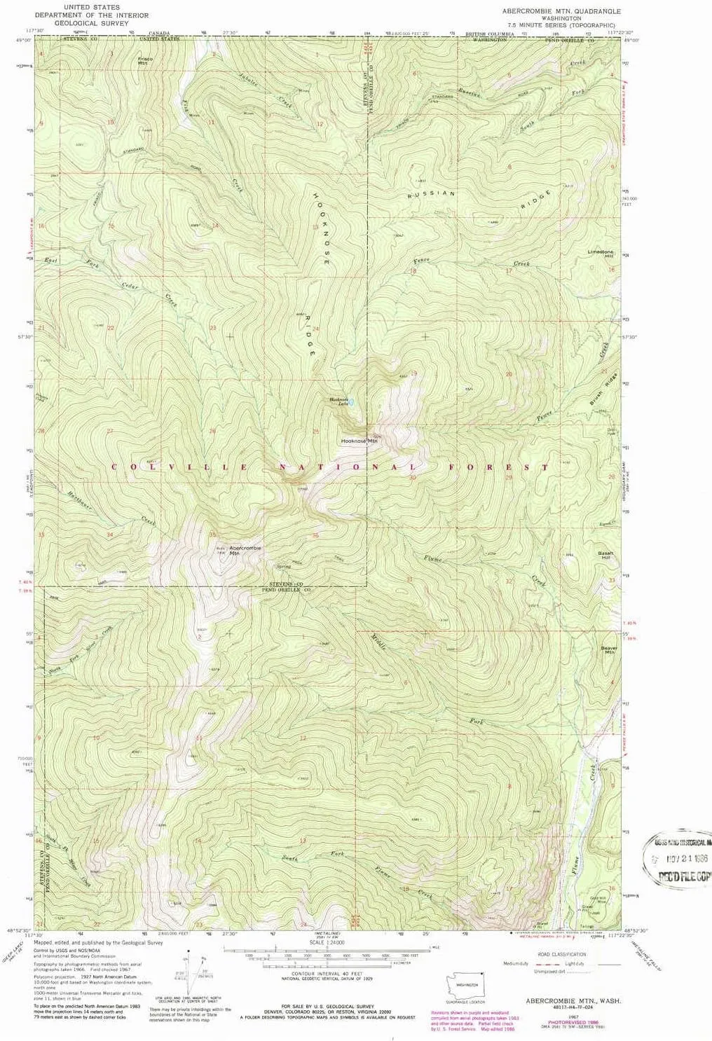
- USGS topographic map of Abercrombie Mtn, WA, at 1:24000 scale. Lighter material. Waterproof. Tear-resistant. Foldable. Very durable. Perfect for backpacking and the outdoors.
- Cities, towns, villages: Please see map preview to find populated places, townships, as well as roads and street names if available.
- Mountains: Limestone Hill,Basalt Hill,Abercrombie Mountain,Frisco Mountain,Hooknose Mountain,Beaver Mountain
- Valleys: Low elevation topographic features such as flatlands, river valleys, and canyons.
USGS topographic map of Abercrombie Mtn, Washington, dated 1967, updated 1986.
Includes geographic coordinates (latitude and longitude), lines of elevation, bodies of water, roads, and more. This topo quad is suitable for recreational, outdoor uses, office applications, or wall map framing.
Printed on-demand by YellowMaps on the print material of your choice.
Shipping rolled from Minneapolis, MN, United States.
Product Number: USGS-5932311
Map Size: 26.9 inches high x 19.3 inches wide
Map Scale: 1:24000
Map Type: POD USGS Topographic Map
Map Series: HTMC
Map Version: Historical
Cell ID: 46
Scan ID: 239719
Imprint Year: 1986
Woodland Tint: Yes
Photo Revision Year: 1986
Aerial Photo Year: 1983
Edit Year: 1986
Field Check Year: 1967
Datum: NAD27
Map Projection: Polyconic
Map published by United States Geological Survey
Keywords: Overedge with No Adjacent Map
Map Language: English
Scanner Resolution: 600 dpi
Map Cell Name: Abercrombie Mountain
Grid size: 7.5 X 7.5 Minute
Date on map: 1967
Geographical region: Washington, United States
Northern map edge Latitude: 49°
Southern map edge Latitude: 48.875°
Western map edge Longitude: -117.5°
Eastern map edge Longitude: -117.375°
Surrounding map sheets (copy & paste the Product No. in the search bar):
North:
East: USGS-5402902,USGS-5402898,USGS-5402904,USGS-5402900
South: USGS-5406320,USGS-5406322,USGS-5406326,USGS-5406324
West: USGS-5687009,USGS-5687007,USGS-5687011,USGS-5687013


")
 Titanium Bowl & Titanium Compact Wood Stove Bundle")
 for Emergency Survival Kits, Camping, Hiking, All-Weather Magnesium Ferro Rod")


, 2.4 Inch 8Cr13MoV Steel Blade with Black Oxide Coating, Every Day Utility Knife with Carbon Strength and High Tech Function, 3.5 oz.,Gray")

